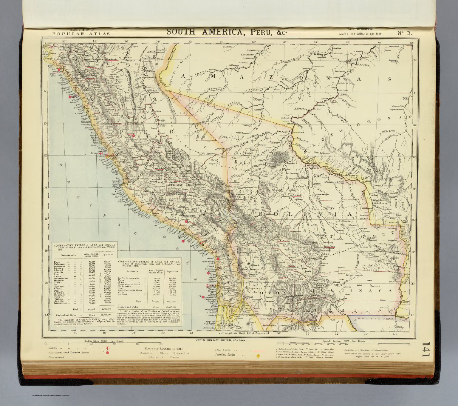
Coloured map of Peru from Letts's popular atlas (London, 1883), with relief shown by hachures and spot heights, according to the description. Part of the David Rumsey Map Collection.
Images may be downloaded and used following Creative Commons CC BY-NC-SA 3.0 license. Image credit should be given to "David Rumsey Map Collection, David Rumsey Map Center, Stanford Libraries." Please contact the David Rumsey Map Collection for commercial use. https://www.davidrumsey.com/about/copyright-and-permissions