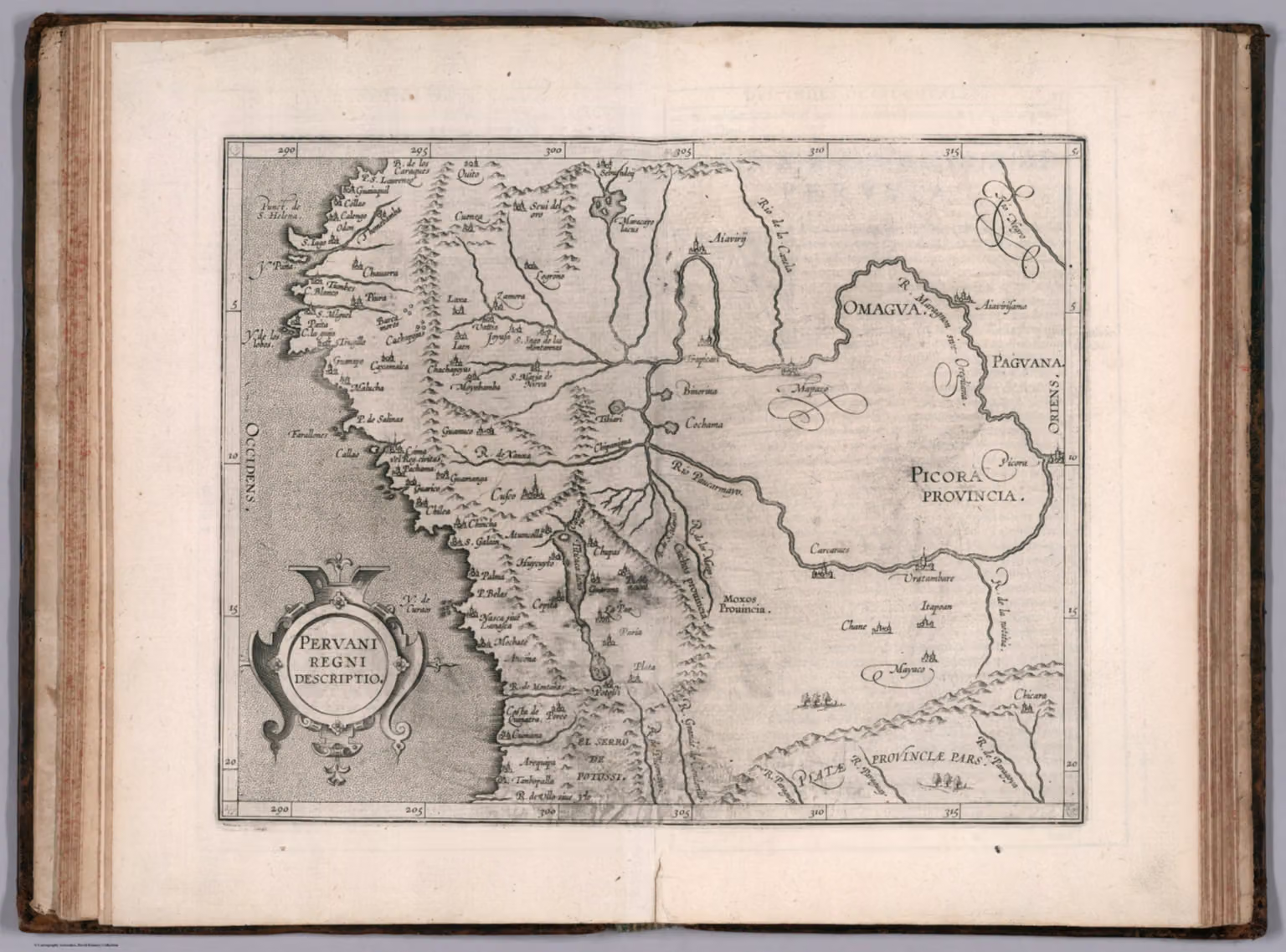
Engraved map of Peru, with parts of Bolivia, Ecuador and Brazil, published in the Histoire universelle des Indes occidentales (Douai, 1611). Part of the David Rumsey Map Collection.
Date
1611
Place
Perú
People
Corneille Wytfliet (author) Giovanni Antonio Magini (author)
Images may be downloaded and used following Creative Commons CC BY-NC-SA 3.0 license. Image credit should be given to "David Rumsey Map Collection, David Rumsey Map Center, Stanford Libraries." Please contact the David Rumsey Map Collection for commercial use. https://www.davidrumsey.com/about/copyright-and-permissions